
Major Mountain Ranges in France, from the Alps to the Pyrenees

France's main mountain ranges are beautiful and varied, from the mighty Alps in the east and southeast to the granite landscape of Morvan in Burgundy.
All offer playgrounds in winter and summer. You can hike, swim, and fish in the summer and ski and enjoy a variety of exciting sports in the winter.
There are opportunities for sightseeing and taking pictures.
In Mont-Blanc, there is a panoramic tram that travels to the Bellevue plateau through pastures and forests.
Winter sports in France go beyond skiing and snowboarding.
You can go paragliding in Alpe d'Huez, sledding in La Plagne, or ice driving in Val Thorens, all in the French Alps.
We hope you enjoy watching this video about Discovering France's Pyrenees
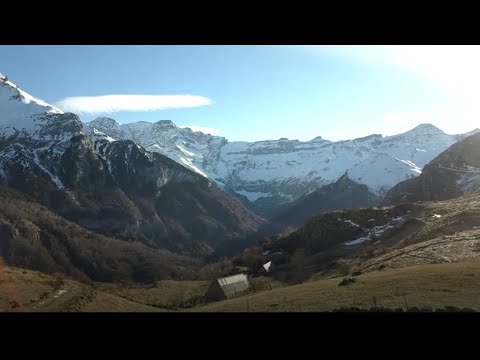
Source: FRANCE 24 English
The French Alps
The French Alps are on the eastern side of the country and border Switzerland and Italy. The highest peak is Mont Blanc.
At 15,774 feet (4,808 meters), it is also the highest mountain in Western Europe. Mont Blanc was first climbed in August 1786 by Jacques Balmat and Michel-Gabriel Paccard.
It is popular with today's climbers who choose one of the two Chamonix routes.
Beneath Mont Blanc, in the Chamonix Valley, you will find some of the best winter sports in the world. But it is also one of the most beautiful parts of France for summer activities such as tall grass walks, mountaineering, and Tour de France-style cycling.
The Alps are one of the highest mountain ranges in the world.
The Alps took hundreds of millions of years to form when African and Eurasian tectonic plates collided, pushing rocks and debris towards the high and rugged mountain peaks seen today.
Covering around 750 miles (1200 km), they span eight countries from Austria and Slovenia in the east; Switzerland, Liechtenstein, Germany, and France to the west; and Italy and Monaco to the south.
The Massif Central and the Auvergne Mountains
The central volcanic massif is geologically the oldest part of the country. It covers a large area of central France, about 15% of the country.
A massif is a section of the earth's crust marked by faults. When the crust moves, the massif retains its structure and moves as a whole. The term also refers to a group of mountains formed by a massif.
There are four main volcanic massifs: Chaîne des Puys, Monts Dore, Monts du Cantal, and Volcanic Velay, all of them different and spectacular in their own way.
The highest peak is the Puy de Sancy, at 1,885 meters (6,184 feet), one of the youngest volcanoes in the Chaîne des Puys.
There are about 450 extinct volcanoes in the Massif.
The Auvergne Volcanoes National Park, founded in 1977, is the largest and oldest regional park in Europe.
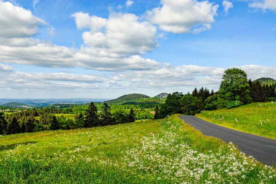
It runs from the south of Clermont Ferrand almost to Aurillac in the west and near St-Flour in the east.
For more information about the region and the volcanoes, visit Vulcania, a nearby educational amusement park.
Auvergne is still relatively unknown to tourists. But it is quite glorious, with its rolling mountains, great rivers, valleys, and forests.
It is a place for hiking, cross-country skiing, bird watching, fishing, and cycling.
There is the main ski resort, Super Besse, in the south, which connects to the Mont-Dore ski resort and is frequented by cross-country skiers.
Several of the great rivers of France are born in Auvergne: the Loire, which is the longest river in France, the Allier, the Cher, and the Sioule.
The Pyrenees
The Pyrenees (les Pyrénées) stretch from the Atlantic to the Mediterranean coast in southern France, marking the border between France and Spain, with the small country of Andorra nestled in the mountains.
The range is 270 miles (430 km) long with its widest point at 80 miles (129 km).
The highest point is Pico do Aneto at 11,169 feet (3,404 meters) in the central massif of the Pyrenees de la Maladeta (which translates to cursed), and there are many other peaks over 9,842 feet (3,000 meters).

The two ends of the range have very different cultural characteristics. In the west, the area is Basque-speaking and in the far eastern Mediterranean, it is Catalan-speaking.
The Languedoc-Roussillon region in the southwest corner is better known as Cathar country, the area where Cathar heretics lived and hid and was finally destroyed by French Crusaders in the 13th century.
If you are in the area, don't miss Montsegur and the castle where the heretics made their last heroic stand.
Located at the foot of the Aspe Valley, on the Franco-Spanish border, is the Parc National des Pyrénées, a paradise for walkers.
There are numerous short trails through the Pyrenees, with one main trail, the GR 10, which runs from coast to coast.
Did you find this post useful or inspiring? Save THIS PIN to your Travel Board on Pinterest! 😊

Once again, thank you for visiting our website!
We hope you've enjoyed exploring the content we've created for you.
Give yourself the chance to learn, get inspired, and have even more fun, keep browsing...
You may also like 👇🏼👇🏼